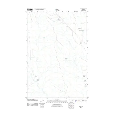
2011 Map of Ahles
USGS Topo · Published 2011About this map
The small settlement of Ahles serves as the focal point for this Rosebud County landscape, where the naming of local waterways hints at the challenges of the early frontier. The drainage network is dominated by the provocatively named Starved to Death Creek and Froze to Death Creek, which define the local topography alongside Geyser Spring Coulee. Evidence of industrial and agricultural development is visible through a series of named earthen structures and resource extraction sites. Local water management is represented by the Kniepp Number 1 Dam, JA Montgomery Number 1 Dam, and Big Timber Number 41 Dam. Meanwhile, the eastern portion of the quadrangle shows significant mining activity with several sites linked to the primary creek, including the West Starved to Death 31,32 Mine and the W Starved to Death 5 Mine, illustrating the intersection of ranching infrastructure and mineral interests in this corner of Montana.
Find a feature on this map
15 named features on this map. Tap any name to fly to it.
Don’t see what you’re looking for? This feature index may not catch every label — zoom into the map to look around manually.
Map Details
Editions of this 2011 Ahles Map
This is the sole edition of this map. No revisions or reprints were ever made.
Other maps of this area

1954 · Forsyth
USGS Topo · 1:250,000

1957 · Forsyth
USGS Topo · 1:250,000

1958 · Forsyth
USGS Topo · 1:250,000

1960 · Hysham
USGS Topo · 1:24,000

1960 · Steie Ranch
USGS Topo · 1:24,000

1960 · Vananda
USGS Topo · 1:24,000

1960 · Ahles
USGS Topo · 1:24,000

1960 · Myers
USGS Topo · 1:24,000

1960 · Sanders
USGS Topo · 1:24,000

1960 · Thebes
USGS Topo · 1:24,000