
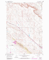
1960 Map of Vananda
USGS Topo · Published 1962About this map
The Chicago Milwaukee St Paul and Pacific railroad cuts a sharp diagonal through this 1960 landscape, defining the corridor for the settlement of Vananda. This small outpost sits near the confluence of Horse Creek and Anderson Creek, serving as a focal point for the surrounding rangeland. The topography is dominated by the prominent Cedar Ridge, which marks the boundary line between Rosebud and Treasure Counties.
Find a feature on this map
16 named features on this map. Tap any name to fly to it.
Don’t see what you’re looking for? This feature index may not catch every label — zoom into the map to look around manually.
Map Details
Editions of this 1960 Vananda Map
2 editions found
Other maps of this area

1954 · Forsyth
USGS Topo · 1:250,000

1957 · Forsyth
USGS Topo · 1:250,000

1958 · Forsyth
USGS Topo · 1:250,000

1960 · Hysham
USGS Topo · 1:24,000

1960 · Ahles
USGS Topo · 1:24,000

1960 · Sanders
USGS Topo · 1:24,000

1960 · Thebes
USGS Topo · 1:24,000

1960 · Zempel Lake
USGS Topo · 1:24,000

1968 · Donleys Reservoir
USGS Topo · 1:24,000

1968 · Finch
USGS Topo · 1:24,000