1960 Map of Zempel Lake
USGS Topo · Published 1962About this map
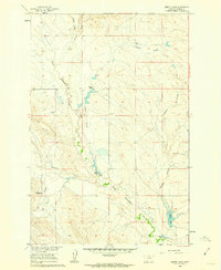
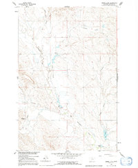
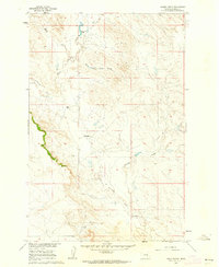
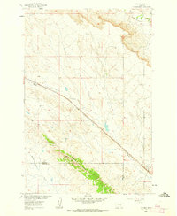
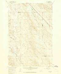
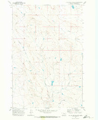
Great Porcupine Creek meanders through this section of Rosebud County, defining a landscape of drainage patterns and isolated cattle operations during the early 1960s. The area is characterized by a series of deep coulees that feed into the larger creek systems, such as Nelson Coulee and McGraw Coulee. These topographic features were critical for local ranchers, who relied on the scattered water sources and protected draws of the Missouri River Basin. Family operations are clearly marked, including the Johnson Ranch and Olson Ranch in the central valley, and the Richardson Ranch to the southwest. In the southeastern corner, Zempel Lake and the nearby Zempel Ranch represent a significant landmark in this high plains environment. The map details the transition between Blacktail Creek and West Blacktail Creek, showing the network of unimproved roads and trails that linked these remote homesteads.
Find a feature on this map
12 named features on this map. Tap any name to fly to it.
Don’t see what you’re looking for? This feature index may not catch every label — zoom into the map to look around manually.
Map Details
Editions of this 1960 Zempel Lake Map
2 editions found
Other maps of this area

1954 · Forsyth
USGS Topo · 1:250,000

1957 · Forsyth
USGS Topo · 1:250,000

1958 · Forsyth
USGS Topo · 1:250,000
1960 · Hagen Ranch
USGS Topo · 1:24,000
1960 · Vananda
USGS Topo · 1:24,000
1960 · Ahles
USGS Topo · 1:24,000
1960 · Thebes
USGS Topo · 1:24,000
1960 · Brown Coulee
USGS Topo · 1:24,000
1968 · Donleys Reservoir
USGS Topo · 1:24,000
1969 · Flat Bottom Coulee SW
USGS Topo · 1:24,000