
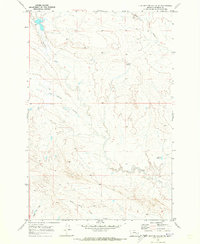
1969 Map of Flat Bottom Coulee SW
USGS Topo · Published 1973About this map
Ahlinger Ranch stands as a primary point of human settlement in this high plains landscape of Rosebud County during the late 1960s. The topography is defined by the complex drainage systems of Flat Bottom Coulee and Longfork Creek, where the seasonal flow of water has carved deep, branching channels through the terrain. These watercourses, including the East Fork and Larson Coulee, dictate the layout of the land, reflecting a remote ranching economy dependent on the natural contours and limited water resources of the Montana interior. The map illustrates a transitional period of land management, marked by section lines and fence boundaries that overlay the winding coulees and intermittent streams common to this part of the state.
Find a feature on this map
6 named features on this map. Tap any name to fly to it.
Don’t see what you’re looking for? This feature index may not catch every label — zoom into the map to look around manually.
Map Details
Editions of this 1969 Flat Bottom Coulee SW Map
This is the sole edition of this map. No revisions or reprints were ever made.
Other maps of this area

1954 · Forsyth
USGS Topo · 1:250,000

1957 · Forsyth
USGS Topo · 1:250,000

1958 · Forsyth
USGS Topo · 1:250,000

1960 · Vananda
USGS Topo · 1:24,000

1960 · Brown Coulee
USGS Topo · 1:24,000

1960 · Zempel Lake
USGS Topo · 1:24,000

1968 · Donleys Reservoir
USGS Topo · 1:24,000

1968 · Finch NE
USGS Topo · 1:24,000

1969 · Flat Bottom Coulee NE
USGS Topo · 1:24,000
1969 · Flat Bottom Coulee SE
USGS Topo · 1:24,000