
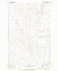
1968 Map of Finch NE
USGS Topo · Published 1972About this map
Dry Creek and Greasewood Creek carve through this Rosebud County landscape, illustrating a classic Montana drainage pattern of coulees and seasonal watercourses. The terrain is defined by its topographic complexity, where deep ravines like Machine Coulee and McGraw Coulee intersect the high plains. A single Drill Hole in the center of the sheet points to mid-century subsurface exploration, a common feature in this region's history of resource assessment.
Find a feature on this map
13 named features on this map. Tap any name to fly to it.
Don’t see what you’re looking for? This feature index may not catch every label — zoom into the map to look around manually.
Map Details
Editions of this 1968 Finch NE Map
This is the sole edition of this map. No revisions or reprints were ever made.
Other maps of this area

1954 · Forsyth
USGS Topo · 1:250,000

1957 · Forsyth
USGS Topo · 1:250,000

1958 · Forsyth
USGS Topo · 1:250,000

1968 · Donleys Reservoir
USGS Topo · 1:24,000

1968 · Nichols
USGS Topo · 1:24,000

1968 · Forsyth
USGS Topo · 1:24,000

1968 · Black Coulee
USGS Topo · 1:24,000

1968 · Finch
USGS Topo · 1:24,000

1969 · Flat Bottom Coulee SW
USGS Topo · 1:24,000
1969 · Rough Creek SW
USGS Topo · 1:24,000