
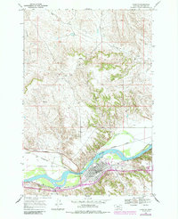
1968 Map of Forsyth
USGS Topo · Published 1972About this map
Forsyth serves as a vital rail and river hub along the Yellowstone River in this late 1960s landscape. The town's layout is defined by the dual presence of the Chicago Milwaukee St Paul and Pacific and the Burlington Northern railroads, which flank the river and provide a glimpse into the era's heavy industrial reliance on rail transport. To the north of the town, the Cartersville Canal cuts across the river's bend, while the Lewis and Clark Trail follows the southern bank, marking the historical significance of this corridor.
Find a feature on this map
27 named features on this map. Tap any name to fly to it.
Don’t see what you’re looking for? This feature index may not catch every label — zoom into the map to look around manually.
Map Details
Editions of this 1968 Forsyth Map
2 editions found
Other maps of this area

1954 · Forsyth
USGS Topo · 1:250,000

1957 · Forsyth
USGS Topo · 1:250,000

1958 · Forsyth
USGS Topo · 1:250,000

1968 · Orinoco
USGS Topo · 1:24,000

1968 · Nichols
USGS Topo · 1:24,000

1968 · Schultz Coulee
USGS Topo · 1:24,000

1968 · Finch NE
USGS Topo · 1:24,000

1968 · Black Coulee
USGS Topo · 1:24,000

1971 · Griffin Coulee NE
USGS Topo · 1:24,000

1971 · Smith Creek NE
USGS Topo · 1:24,000