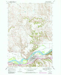
1968 Map of Forsyth
USGS Topo · Published 1985About this map
The Yellowstone River cuts a wide path through this northern plains landscape, anchoring the development of Forsyth and the surrounding valley. As the county seat of Rosebud County, the town's industrial and transportation identity is clearly defined by the heavy presence of the Burlington Northern line and a large Roundhouse facility near the riverbank. This map shows the intricate irrigation network essential to the region's agriculture, including the Cartersville Canal and Hammond Canal that parallel the river's flow.
Find a feature on this map
23 named features on this map. Tap any name to fly to it.
Don’t see what you’re looking for? This feature index may not catch every label — zoom into the map to look around manually.
Map Details
Editions of this 1968 Forsyth Map
2 editions found
Other maps of this area

1954 · Forsyth
USGS Topo · 1:250,000

1957 · Forsyth
USGS Topo · 1:250,000

1958 · Forsyth
USGS Topo · 1:250,000

1968 · Orinoco
USGS Topo · 1:24,000

1968 · Nichols
USGS Topo · 1:24,000

1968 · Forsyth
USGS Topo · 1:24,000

1968 · Schultz Coulee
USGS Topo · 1:24,000

1968 · Finch NE
USGS Topo · 1:24,000

1968 · Black Coulee
USGS Topo · 1:24,000

1971 · Griffin Coulee NE
USGS Topo · 1:24,000