
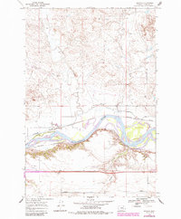
1968 Map of Orinoco
USGS Topo · Published 1972About this map
The Yellowstone River cuts a wide path through this portion of Rosebud County, Montana, defining a landscape of irrigation and heavy transport in the late 1960s. The northern bank is marked by the small settlement of Orinoco and the Cartersville Canal, which draws water from the river to support local agriculture. The importance of this corridor for regional movement is evident in the parallel alignments of the Chicago Milwaukee St Paul and Pacific and Burlington Northern railroads, which hug the river's path. To the south, the Lewis and Clark Trail and a local Weigh Station highlight the modern highway system’s role. The terrain transitions from the alluvial bottomlands of Flynn Island to the dissected uplands carved by Little Porcupine Creek and Wildcat Coulee, where a network of pipelines and service roads suggests the region's energy infrastructure and ranching activity.
Find a feature on this map
16 named features on this map. Tap any name to fly to it.
Don’t see what you’re looking for? This feature index may not catch every label — zoom into the map to look around manually.
Map Details
Editions of this 1968 Orinoco Map
2 editions found
Other maps of this area

1954 · Forsyth
USGS Topo · 1:250,000

1957 · Forsyth
USGS Topo · 1:250,000

1958 · Forsyth
USGS Topo · 1:250,000

1968 · Rosebud
USGS Topo · 1:24,000

1968 · Box Canyon Coulee
USGS Topo · 1:24,000

1968 · Forsyth
USGS Topo · 1:24,000

1968 · Schultz Coulee
USGS Topo · 1:24,000

1968 · Black Coulee
USGS Topo · 1:24,000

1971 · Smith Creek NE
USGS Topo · 1:24,000
1971 · Smith Creek
USGS Topo · 1:24,000