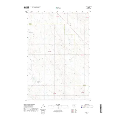
2020 Map of Ahles
USGS Topo · Published 2020About this map
Ahles sits at the junction of State Highway 12 in a region defined by evocative drainage names and the crossing of the Rosebud Co Treasure Co boundary. This high-plains landscape is etched by deep seasonal watercourses including Starved to Death Cr and Froze to Death Cr, labels that speak to the historical hardship of the early ranching era in this part of Montana. The topography is dominated by the Geyser Spring Coulee which cuts through the western sections of the township. Mapping of these drainages, including Horse Cr, provides a detailed view of the water sources and natural corridors that have dictated settlement and transportation patterns across this expanse of eastern Montana.
Find a feature on this map
14 named features on this map. Tap any name to fly to it.
Don’t see what you’re looking for? This feature index may not catch every label — zoom into the map to look around manually.
Map Details
Editions of this 2020 Ahles Map
This is the sole edition of this map. No revisions or reprints were ever made.
Other maps of this area

1954 · Forsyth
USGS Topo · 1:250,000

1957 · Forsyth
USGS Topo · 1:250,000

1958 · Forsyth
USGS Topo · 1:250,000

1960 · Hysham
USGS Topo · 1:24,000

1960 · Steie Ranch
USGS Topo · 1:24,000

1960 · Vananda
USGS Topo · 1:24,000

1960 · Ahles
USGS Topo · 1:24,000

1960 · Myers
USGS Topo · 1:24,000

1960 · Sanders
USGS Topo · 1:24,000

1960 · Thebes
USGS Topo · 1:24,000