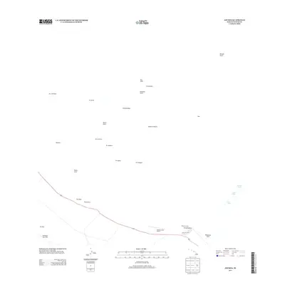
2013 Map of Ahumoa
USGS Topo · Published 2013About this map
The high-elevation saddle between massive volcanic peaks on the Island of Hawai'i is dominated by the military infrastructure of Bradshaw Army Airfield and the nearby Pʼnhakuloa Camp. This 2013 survey illustrates the stark, high-altitude landscape where ancient cinder cones, or pu'u, such as Ahumoa and Pu'upʼnhakuloa, dot a terrain marked by the Ke'āmuku Lava Flow. The transportation network is anchored by the Mauna Kea Loop road, providing access to this demanding environment. Water remains a critical and scarce resource in this region, evidenced by the presence of isolated points like Hopukani Springs, Waihi Spring, and Liloe Spring. The map documents a complex geography of drainage gulches, including Kemole Gulch and Pʼnhakuloa Gulch, which carve through the volcanic slopes of the island's interior.
Find a feature on this map
29 named features on this map. Tap any name to fly to it.
Don’t see what you’re looking for? This feature index may not catch every label — zoom into the map to look around manually.
Map Details
Editions of this 2013 Ahumoa Map
This is the sole edition of this map. No revisions or reprints were ever made.
Other maps of this area

1927 · Kaohe
USGS Topo · 1:62,500

1930 · Humuula
USGS Topo · 1:62,500

1930 · Kaohe
USGS Topo · 1:62,500

1954 · Hawaii North
USGS Topo · 1:250,000

1956 · Puu Oo
USGS Topo · 1:24,000

1956 · Puu Koli
USGS Topo · 1:24,000

1956 · Keamuku
USGS Topo · 1:24,000

1956 · Nohonaohae
USGS Topo · 1:24,000

1956 · Makahalau
USGS Topo · 1:24,000
1956 · Ahumoa
USGS Topo · 1:24,000