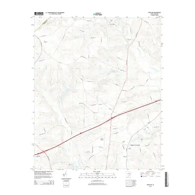
2014 Map of Aiken NW
USGS Topo · Published 2014About this map
Seiglers Crossroads serves as a central junction in this rural landscape northeast of the city of Aiken, where modern infrastructure meets historical family landmarks. The area is defined by the winding course of the South Fork Edisto River and its numerous tributaries, including Jumping Gut Cr and Bridge Cr, which have shaped the local topography and settlement patterns. For those researching local history or genealogy, the map identifies several small burial grounds such as Timmerman Cem, Cumbee Cem, and Mt Pisgah Cem, alongside larger named water bodies like Lake Josephine and Holmes Long Branch Pond. The presence of the Aiken Municipal Airport and the crossing of Us-1 highlight the region's role as a transportation corridor connecting the smaller communities of Aiken County and Edgefield County.
Find a feature on this map
91 named features on this map. Tap any name to fly to it.
Don’t see what you’re looking for? This feature index may not catch every label — zoom into the map to look around manually.
Map Details
Editions of this 2014 Aiken NW Map
This is the sole edition of this map. No revisions or reprints were ever made.
Other maps of this area

1920 · Aiken
USGS Topo · 1:48,000

1921 · Aiken
USGS Topo · 1:62,500

1923 · Warrenville
USGS Topo · 1:48,000

1928 · Warrenville
USGS Topo · 1:62,500

1943 · Aiken
USGS Topo · 1:62,500

1943 · Warrenville
USGS Topo · 1:62,500

1954 · Augusta
USGS Topo · 1:250,000

1957 · Augusta
USGS Topo · 1:250,000

1958 · Augusta
USGS Topo · 1:250,000

1961 · Augusta
USGS Topo · 1:250,000