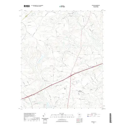
2020 Map of Aiken NW
USGS Topo · Published 2020About this map
Seiglers Crossroads anchors the southeastern landscape of this Aiken County region, where the South Fork Edisto River forms a prominent natural boundary to the northeast. The geography is defined by a dense network of tributaries including Bridge Cr, Mile Br, and Dairy Br, which feed into local water bodies like Lake Josephine and Morris Lake. This modern survey reveals a rural area in transition, with the sprawling Aiken Regional Airport occupying a central plateau above the surrounding stream valleys.
Find a feature on this map
109 named features on this map. Tap any name to fly to it.
Don’t see what you’re looking for? This feature index may not catch every label — zoom into the map to look around manually.
Map Details
Editions of this 2020 Aiken NW Map
This is the sole edition of this map. No revisions or reprints were ever made.
Other maps of this area

1920 · Aiken
USGS Topo · 1:48,000

1921 · Aiken
USGS Topo · 1:62,500

1923 · Warrenville
USGS Topo · 1:48,000

1928 · Warrenville
USGS Topo · 1:62,500

1943 · Aiken
USGS Topo · 1:62,500

1943 · Warrenville
USGS Topo · 1:62,500

1954 · Augusta
USGS Topo · 1:250,000

1957 · Augusta
USGS Topo · 1:250,000

1958 · Augusta
USGS Topo · 1:250,000

1961 · Augusta
USGS Topo · 1:250,000