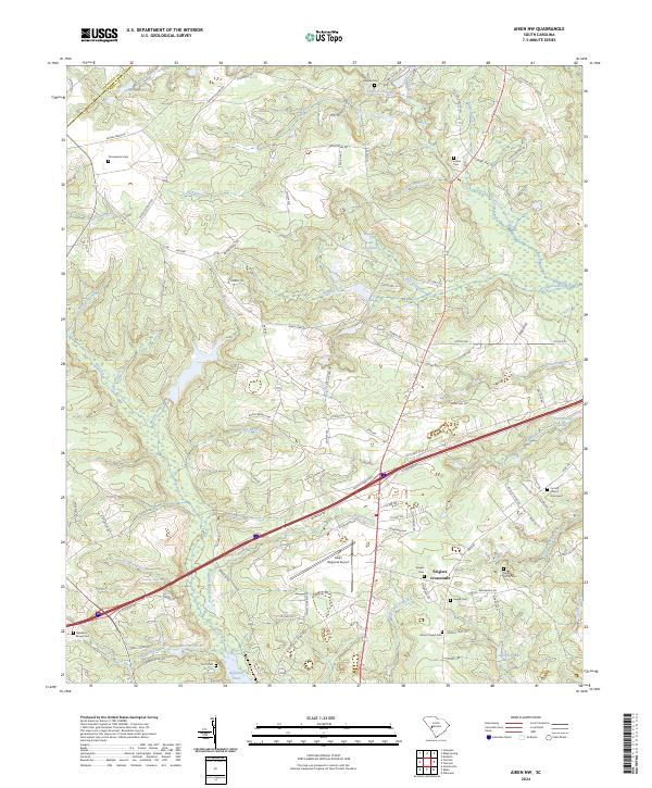
2024 Map of Aiken NW
USGS Topo · Published 2024About this map
The South Fork Edisto River flows through this corner of South Carolina, where the terrain is defined by a dense network of tributaries including Jumping Gut Creek, Mile Branch, and Shaw Creek. Near Seiglers Crossroads, the landscape transitions from the residential and aviation infrastructure of the Aiken Regional Airport to more rural stretches marked by family histories. Local genealogists will find several burial sites preserved here, such as the Seigler Family Cem, Timmerman Cem, and the Central Church Graveyard. The area around Lake Josephine and Morris Lake illustrates the region's managed water resources, while the presence of Camp Long on Camp Long Lake highlights local recreational development along the creek beds. This modern topographic record maintains the nomenclature of established road networks like Old Four Notch RD and Archie Ware RD.
Find a feature on this map
112 named features on this map. Tap any name to fly to it.
Don’t see what you’re looking for? This feature index may not catch every label — zoom into the map to look around manually.
Map Details
Editions of this 2024 Aiken NW Map
This is the sole edition of this map. No revisions or reprints were ever made.
Other maps of this area

1920 · Aiken
USGS Topo · 1:48,000

1921 · Aiken
USGS Topo · 1:62,500

1923 · Warrenville
USGS Topo · 1:48,000

1928 · Warrenville
USGS Topo · 1:62,500

1943 · Aiken
USGS Topo · 1:62,500

1943 · Warrenville
USGS Topo · 1:62,500

1954 · Augusta
USGS Topo · 1:250,000

1957 · Augusta
USGS Topo · 1:250,000

1958 · Augusta
USGS Topo · 1:250,000

1961 · Augusta
USGS Topo · 1:250,000