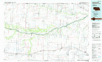
1985 Map of Ainsworth
USGS Topo · Published 1985About this map
Ainsworth and Bassett serve as the primary hubs in this mid-1980s survey of the northern Sandhills region, where the Chicago and North Western railroad parallels the southern corridor near Route 20. The landscape is defined by the deeply incised valleys of the Niobrara River and the Keya Paha River, which cut through a high prairie plateau marked by features like Huddle Table and Antelope Peak. Numerous small settlements such as Springview, Stuart, and Mariaville are linked by a network of rural roads, while isolated landing strips like Gipson Landing Strip and Stoltenberg Landing Strip highlight the reliance on aviation in this sparsely populated cattle country. The transition from the rugged river breaks to the flatter tablelands is clearly visible, punctuated by conservation lands including the Thomas Creek State Wildlife Management Area.
Find a feature on this map
88 named features on this map. Tap any name to fly to it.
Don’t see what you’re looking for? This feature index may not catch every label — zoom into the map to look around manually.
Map Details
Editions of this 1985 Ainsworth Map
2 editions found
Other maps of this area

1949 · Dutch Creek
USGS Topo · 1:24,000

1949 · Jamison SW
USGS Topo · 1:24,000

1949 · Riverview
USGS Topo · 1:24,000

1949 · Carns
USGS Topo · 1:24,000

1950 · Bassett NW
USGS Topo · 1:24,000

1950 · Norden
USGS Topo · 1:62,500

1950 · Carns
USGS Topo · 1:24,000

1950 · Riverview
USGS Topo · 1:24,000

1950 · Meadville
USGS Topo · 1:24,000

1950 · Huddle Table
USGS Topo · 1:24,000