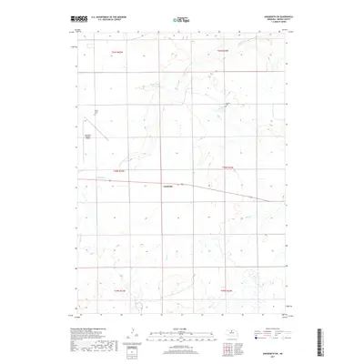
2017 Map of Ainsworth SW
USGS Topo · Published 2017About this map
Sandridge occupies a central position in this Brown County landscape, where the Sand Hills terrain is defined by a network of ephemeral watercourses and small ranching reservoirs. The drainage patterns of Sand Draw and Bone Cr cut through the sections, illustrating the hydrologic character of the region. Local history is anchored by the Grand Prairie Cem in the northwest and the German Cem further east, which serve as long-standing markers of the area's early settlement. The presence of the Ainsworth Regional Airport near the western edge of the map highlights the modern transportation infrastructure serving this rural part of the state. Small-scale water management is evident through features like the Snyder Group Reservoir and Budde Reservoir, which reflect the essential relationship between water access and the local agricultural economy.
Find a feature on this map
14 named features on this map. Tap any name to fly to it.
Don’t see what you’re looking for? This feature index may not catch every label — zoom into the map to look around manually.
Map Details
Editions of this 2017 Ainsworth SW Map
This is the sole edition of this map. No revisions or reprints were ever made.
Other maps of this area

1949 · Dutch Creek
USGS Topo · 1:24,000

1950 · Dutch Creek
USGS Topo · 1:24,000

1950 · Wood Lake
USGS Topo · 1:62,500

1951 · Moon Lake
USGS Topo · 1:62,500

1954 · Ainsworth NW
USGS Topo · 1:24,000

1954 · Ainsworth SW
USGS Topo · 1:24,000

1954 · Ainsworth
USGS Topo · 1:24,000

1955 · O'Neill
USGS Topo · 1:250,000

1957 · Valentine
USGS Topo · 1:250,000

1959 · Valentine
USGS Topo · 1:250,000