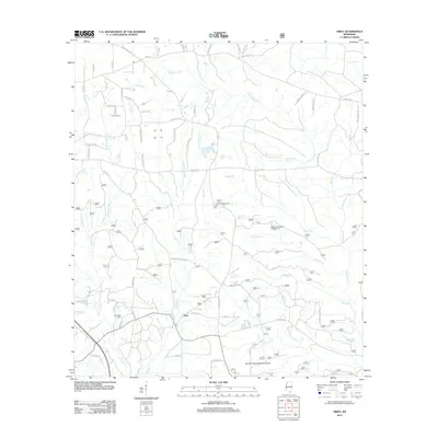
2012 Map of Airey
USGS Topo · Published 2012About this map
Airey serves as the primary settlement hub in this part of Harrison County, situated within a landscape defined by the dense hydrological network of the Pine Belt. The map reveals a high concentration of family-named roads such as Russ Bond Rd, Emmitt Bond Rd, and Cliff Oneal Rd, indicating deep-rooted land tracts and local genealogy. Central to the area is the Harrison Experimental Forest, a significant research forest providing a buffer for various water systems including Tuxachanie Cr and Saucier Cr. The presence of the Broadus Cem and the Airey Lookout Tower provides specific points of interest for researchers tracking local burials or historical forestry infrastructure. In the east, the Bigfoot Trail Riders Campground and trails like Big Foot Trl highlight the region's recreational use within the managed timberlands, while a complex web of seasonal and permanent streams like Spike Buck Cr and Boggy Br feed into the larger river systems of southern Mississippi.
Find a feature on this map
76 named features on this map. Tap any name to fly to it.
Don’t see what you’re looking for? This feature index may not catch every label — zoom into the map to look around manually.
Map Details
Editions of this 2012 Airey Map
This is the sole edition of this map. No revisions or reprints were ever made.
Other maps of this area

1947 · Wiggins
USGS Topo · 1:62,500

1947 · Benndale
USGS Topo · 1:62,500

1949 · Wiggins
USGS Topo · 1:62,500

1949 · Benndale
USGS Topo · 1:62,500

1953 · Mobile
USGS Topo · 1:250,000

1954 · Vestry
USGS Topo · 1:62,500

1954 · McHenry
USGS Topo · 1:62,500

1957 · Mobile
USGS Topo · 1:250,000

1960 · Mobile
USGS Topo · 1:250,000

1963 · Mobile
USGS Topo · 1:250,000