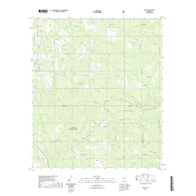
2021 Map of Airey
USGS Topo · Published 2021About this map
De Soto National Forest blankets this landscape on the Stone and Harrison County line, where the small settlement of Airey serves as a central landmark. The terrain is defined by a dense network of blackwater drainages including Tuxachanie Creek, Beaver Dam Creek, and Saucier Creek. This 2021 survey illustrates a modern rural layout where traditional timberland access meets modern residential roads. Family and community history is preserved in sites like Sunflower Cemetery in the north and Broadus Cemetery near the southern edge. The map also traces established routes like Old US Hwy 49 and Wire Road East, reflecting the long-standing transportation corridors that have shaped this portion of the Mississippi piney woods for generations.
Find a feature on this map
103 named features on this map. Tap any name to fly to it.
Don’t see what you’re looking for? This feature index may not catch every label — zoom into the map to look around manually.
Map Details
Editions of this 2021 Airey Map
This is the sole edition of this map. No revisions or reprints were ever made.
Other maps of this area

1947 · Wiggins
USGS Topo · 1:62,500

1947 · Benndale
USGS Topo · 1:62,500

1949 · Wiggins
USGS Topo · 1:62,500

1949 · Benndale
USGS Topo · 1:62,500

1953 · Mobile
USGS Topo · 1:250,000

1954 · Vestry
USGS Topo · 1:62,500

1954 · McHenry
USGS Topo · 1:62,500

1957 · Mobile
USGS Topo · 1:250,000

1960 · Mobile
USGS Topo · 1:250,000

1963 · Mobile
USGS Topo · 1:250,000