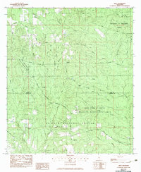
1982 Map of Airey
USGS Topo · Published 1983About this map
De Soto National Forest and the Red Creek State Wildlife Management Area dominate this landscape on the border of Stone and Harrison Counties. The settlement of Airey serves as a small focal point in an area characterized by its extensive network of creeks and branches, including Tuxachanie Creek and Beaver Dam Creek. A notable presence in the northeast is the University of Mississippi Forest, indicating the region's long-standing role in timber management and forestry research.
Find a feature on this map
39 named features on this map. Tap any name to fly to it.
Don’t see what you’re looking for? This feature index may not catch every label — zoom into the map to look around manually.
Map Details
Editions of this 1982 Airey Map
This is the sole edition of this map. No revisions or reprints were ever made.
Other maps of this area

1947 · Wiggins
USGS Topo · 1:62,500

1947 · Benndale
USGS Topo · 1:62,500

1949 · Wiggins
USGS Topo · 1:62,500

1949 · Benndale
USGS Topo · 1:62,500

1953 · Mobile
USGS Topo · 1:250,000

1954 · Vestry
USGS Topo · 1:62,500

1954 · McHenry
USGS Topo · 1:62,500

1957 · Mobile
USGS Topo · 1:250,000

1960 · Mobile
USGS Topo · 1:250,000

1963 · Mobile
USGS Topo · 1:250,000