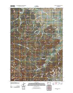
2011 Map of Airlie South
USGS Topo · Published 2011About this map
Airlie and the rural hills of Benton County are captured in this 2011 survey, showing a landscape defined by its complex drainage systems and varied topography. The small settlement of Airlie sits at the northern edge of the map near Williams Cemetery, while the southern reaches transition into the residential development of Crescent Valley. The terrain is marked by significant elevations including Forest Peak and Vineyard Mountain, separated by the Lewisburg Saddle. Water management is evident throughout the region, from the Kenney Reservoir and Oakshire Reservoir to the numerous forks of Berry Creek and Soap Creek that carve through the hills. A dense network of logging and rural roads, such as Dunn Forest Rd and S Boundary Rd, provides access to the higher ridges and timberlands that characterize much of this coastal range foothills environment.
Find a feature on this map
69 named features on this map. Tap any name to fly to it.
Don’t see what you’re looking for? This feature index may not catch every label — zoom into the map to look around manually.
Map Details
Editions of this 2011 Airlie South Map
This is the sole edition of this map. No revisions or reprints were ever made.
Other maps of this area

1913 · Philomath
USGS Topo · 1:31,680

1913 · Oakville
USGS Topo · 1:31,680

1913 · Wells
USGS Topo · 1:31,680

1914 · Independence
USGS Topo · 1:31,680

1914 · Soap Creek
USGS Topo · 1:31,680

1916 · Albany
USGS Topo · 1:62,500

1917 · Salem
USGS Topo · 1:62,500

1921 · Corvallis
USGS Topo · 1:62,500

1922 · Airlie
USGS Topo · 1:31,680

1940 · Salem
USGS Topo · 1:62,500