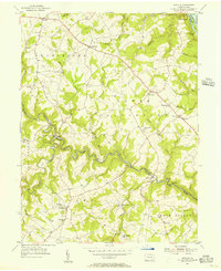
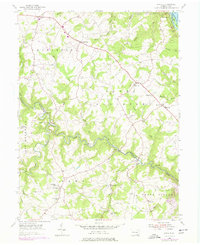
1955 Map of Airville
USGS Topo · Published 1956About this map
Muddy Creek Forks and the surrounding river hills represent a landscape defined by sharp elevation changes and the legacy of the Maryland and Pennsylvania rail line. In the mid-1950s, this portion of York County maintained a dense network of rural communities, from the hilltop settlement of Airville down to the riverside at York Furnace. The terrain is deeply incised by the Susquehanna River and its tributaries, including Otter Creek and Furnace Run. A distinctive cultural landmark, the Indian Steps Museum, sits along the riverbank, reflecting the area's long-standing connection to its riverine history. The map captures the distribution of several community hubs such as McKendree Ch and Guinston Ch, alongside schools like Mt Pleasant Sch and Collins Sch, which served the farming families of Chanceford and Lower Chanceford townships.
Find a feature on this map
57 named features on this map. Tap any name to fly to it.
Don’t see what you’re looking for? This feature index may not catch every label — zoom into the map to look around manually.
Map Details
Editions of this 1955 Airville Map
5 editions found
Other maps of this area

1900 · Parkton
USGS Topo · 1:62,500

1901 · Belair
USGS Topo · 1:62,500

1902 · Parkton
USGS Topo · 1:62,500

1908 · York
USGS Topo · 1:62,500

1910 · York
USGS Topo · 1:62,500

1912 · Mc Calls Ferry
USGS Topo · 1:62,500

1942 · Bel Air
USGS Topo · 1:62,500

1943 · Mc Calls Ferry
USGS Topo · 1:62,500

1944 · Norrisville
USGS Topo · 1:31,680

1945 · Bel Air
USGS Topo · 1:62,500
Featured Places
- Martic Township, PA
- East Hopewell Township, PA
- Lower Chanceford Township, PA
- Peach Bottom Township, PA
- Chanceford Township, PA