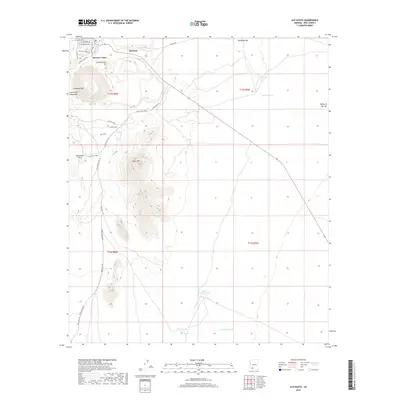
2018 Map of Ajo South
USGS Topo · Published 2018About this map
Mexican Town and Rowood sit at the northern edge of this high-desert landscape, dominated by the mining-related topography of Concentrator Hill. This 2018 survey documents a region defined by arid water management and rugged landforms, where the Little Ajo Mountains rise sharply above the Valley of the Ajo. Grounded in the copper-mining history of Pima County, the map details industrial infrastructure like Pipeline Rd alongside natural landmarks such as Arkansas Mtn and the distinctively shaped Locomotive Rock. Transportation through the area follows established desert corridors like Bates Well Road and Darby Well Road, which intersect near old watering points including Hotshot Tank and Eberling Tank. Drainage patterns across the basin are traced through the seasonal courses of Darby Arroyo and Gunsight Wash, providing a clear view of the water-stressed environment surrounding these historic settlements.
Find a feature on this map
32 named features on this map. Tap any name to fly to it.
Don’t see what you’re looking for? This feature index may not catch every label — zoom into the map to look around manually.
Map Details
Editions of this 2018 Ajo South Map
This is the sole edition of this map. No revisions or reprints were ever made.
Other maps of this area

1932 · Ajo
USGS Topo · 1:62,500

1934 · Ajo
USGS Topo · 1:62,500

1953 · Ajo
USGS Topo · 1:250,000

1957 · Ajo
USGS Topo · 1:250,000

1958 · Ajo
USGS Topo · 1:250,000

1962 · Ajo
USGS Topo · 1:250,000

1963 · Ajo
USGS Topo · 1:250,000

1963 · Ajo
USGS Topo · 1:62,500

1963 · Sikort Chuapo Mts
USGS Topo · 1:62,500

1963 · Mt. Ajo
USGS Topo · 1:62,500