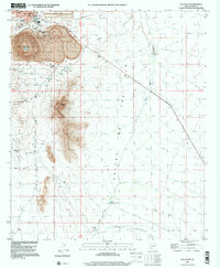
1996 Map of Ajo South
USGS Topo · Published 2000About this map
The New Cornelia Mine dominates the northern landscape of this Pima County quadrangle, showing the massive industrial footprint of open-pit mining operations just south of Ajo. The map reveals a complex infrastructure of Mine Shafts, numerous Prospects, and a South Dam Tailings Pond that underscore the area's copper-driven economy. Near the town center, local life is represented by the High Sch, a Comm Tower, and a lone Grave located near several Water Tanks.
Find a feature on this map
27 named features on this map. Tap any name to fly to it.
Don’t see what you’re looking for? This feature index may not catch every label — zoom into the map to look around manually.
Map Details
Editions of this 1996 Ajo South Map
This is the sole edition of this map. No revisions or reprints were ever made.
Other maps of this area

1932 · Ajo
USGS Topo · 1:62,500

1934 · Ajo
USGS Topo · 1:62,500

1953 · Ajo
USGS Topo · 1:250,000

1957 · Ajo
USGS Topo · 1:250,000

1958 · Ajo
USGS Topo · 1:250,000

1962 · Ajo
USGS Topo · 1:250,000

1963 · Ajo
USGS Topo · 1:250,000

1963 · Ajo
USGS Topo · 1:62,500

1963 · Sikort Chuapo Mts
USGS Topo · 1:62,500

1963 · Mt. Ajo
USGS Topo · 1:62,500