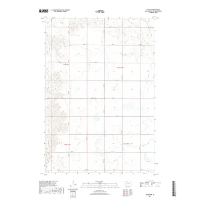
2017 Map of Akaska NW
USGS Topo · Published 2017About this map
Walworth County land division is the defining characteristic of this landscape in north-central South Dakota. The map illustrates a strictly organized section line grid where local infrastructure follows the Public Land Survey System boundaries, specifically within townships t123n r78w, t123n r77w, t122n r78w, and t122n r77w. This systematic layout is reinforced by a network of rural roads such as 131st St and 139th St, which serve the expansive agricultural parcels between 297th Ave and 302nd Ave. The terrain is marked by subtle elevation changes and numerous small depressions, typical of the glacial till plains in this region. This survey captures the enduring rural character of the Great Plains, where the geometry of nineteenth-century land laws continues to dictate the placement of every road and boundary.
Find a feature on this map
18 named features on this map. Tap any name to fly to it.
Don’t see what you’re looking for? This feature index may not catch every label — zoom into the map to look around manually.
Map Details
Editions of this 2017 Akaska NW Map
This is the sole edition of this map. No revisions or reprints were ever made.
Other maps of this area

1953 · McIntosh
USGS Topo · 1:250,000

1958 · McIntosh
USGS Topo · 1:250,000

1967 · Glenham
USGS Topo · 1:24,000

1967 · Selby SW
USGS Topo · 1:24,000

1967 · Selby
USGS Topo · 1:24,000

1968 · Moreau NE
USGS Topo · 1:24,000

1968 · Akaska NW
USGS Topo · 1:24,000

1968 · Akaska SW
USGS Topo · 1:24,000

1968 · Akaska
USGS Topo · 1:24,000

1968 · Moreau SE
USGS Topo · 1:24,000