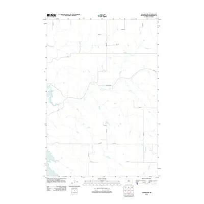
2012 Map of Akaska SW
USGS Topo · Published 2012About this map
Old Zion Cem stands as a quiet focal point in this 2012 survey of the rural landscape south of Akaska. The map documents a sparsely populated region of Walworth County defined by the sprawling waters of Lake Oahe along its western edge. The drainage patterns of the Missouri River plateau are clearly marked by the winding paths of Swan Cr, Pero Cr, and Rieger Cr, which carve through the sectional grid of the Missouri River Breaks. A network of township roads, such as Sloan Creek Rd and 300th Ave, provides structure to this agricultural area, illustrating the enduring survey lines that govern the plains. This topographic study captures the intersection of natural riparian systems and the long-established cemetery that serves as a vital genealogical marker for local families.
Find a feature on this map
18 named features on this map. Tap any name to fly to it.
Don’t see what you’re looking for? This feature index may not catch every label — zoom into the map to look around manually.
Map Details
Editions of this 2012 Akaska SW Map
This is the sole edition of this map. No revisions or reprints were ever made.
Other maps of this area

1953 · McIntosh
USGS Topo · 1:250,000

1958 · McIntosh
USGS Topo · 1:250,000

1968 · Moreau NE
USGS Topo · 1:24,000

1968 · Akaska NW
USGS Topo · 1:24,000

1968 · Akaska SW
USGS Topo · 1:24,000

1968 · Akaska
USGS Topo · 1:24,000

1968 · Moreau SE
USGS Topo · 1:24,000

1968 · Akaska NE
USGS Topo · 1:24,000

1969 · Four Bear Creek
USGS Topo · 1:24,000

1970 · Steamboat Creek
USGS Topo · 1:24,000