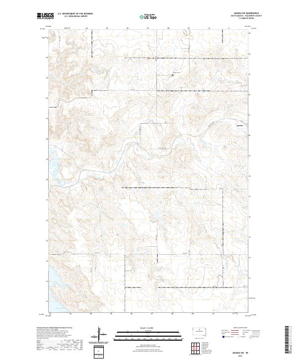
2021 Map of Akaska SW
USGS Topo · Published 2021About this map
Swan Creek and its tributary Rieger Cr carve a path across this Walworth County landscape, flowing toward the expansive waters of Lake Oahe in the southwest corner. The small settlement of Akaska is situated on the eastern edge of the quadrangle, connected to the surrounding prairie by a grid of rural routes including Swan Creek Rd and Sloan Creek Rd. This area reflects the organized land division of the Public Land Survey System, with township lines for T122N and T121N clearly demarcating the territory. For those tracing local history, the Old Zion Cem stands as a notable landmark in the northern section of the map, while the terrain is further defined by smaller drainages such as Pero Cr. The map illustrates a contemporary view of this agricultural region where the natural drainage of the Missouri River plateau meets the modern infrastructure of the northern plains.
Find a feature on this map
23 named features on this map. Tap any name to fly to it.
Don’t see what you’re looking for? This feature index may not catch every label — zoom into the map to look around manually.
Map Details
Editions of this 2021 Akaska SW Map
This is the sole edition of this map. No revisions or reprints were ever made.
Other maps of this area

1953 · McIntosh
USGS Topo · 1:250,000

1958 · McIntosh
USGS Topo · 1:250,000

1968 · Moreau NE
USGS Topo · 1:24,000

1968 · Akaska NW
USGS Topo · 1:24,000

1968 · Akaska SW
USGS Topo · 1:24,000

1968 · Akaska
USGS Topo · 1:24,000

1968 · Moreau SE
USGS Topo · 1:24,000

1968 · Akaska NE
USGS Topo · 1:24,000

1969 · Four Bear Creek
USGS Topo · 1:24,000

1970 · Steamboat Creek
USGS Topo · 1:24,000