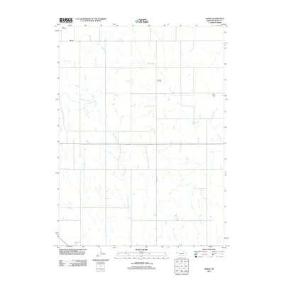
2011 Map of Akron
USGS Topo · Published 2011About this map
Akron sits in the northwest corner of this Boone County landscape, a small community defined by its proximity to the headwaters of regional drainages. The area is characterized by a network of waterways including Plum Creek and Silver Valley Creek, which meander through a grid of rural roads. These water sources have long been central to the local agricultural economy, evidenced by infrastructure such as Kruse Dam. Family history and local heritage are anchored by the Akron Cemetery and Dennison Cemetery, both situated along the township's section lines. The map reveals the precise layout of local infrastructure, from Dennison Rd to the regional corridor of Route 91, showing how transportation and drainage patterns influenced the placement of homesteads and community centers in this portion of Nebraska.
Find a feature on this map
9 named features on this map. Tap any name to fly to it.
Don’t see what you’re looking for? This feature index may not catch every label — zoom into the map to look around manually.
Map Details
Editions of this 2011 Akron Map
This is the sole edition of this map. No revisions or reprints were ever made.
Other maps of this area

1954 · Cedar Rapids
USGS Topo · 1:24,000

1954 · Spalding
USGS Topo · 1:24,000

1954 · Akron
USGS Topo · 1:24,000

1954 · Albion West
USGS Topo · 1:24,000

1954 · Cedar Rapids SE
USGS Topo · 1:24,000

1954 · Spalding SE
USGS Topo · 1:24,000

1955 · Broken Bow
USGS Topo · 1:250,000

1956 · Broken Bow
USGS Topo · 1:250,000

1960 · Spalding 2 SE
USGS Topo · 1:24,000

1963 · Petersburg
USGS Topo · 1:24,000