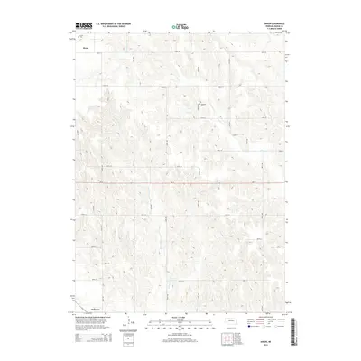
2014 Map of Akron
USGS Topo · Published 2014About this map
Akron and the northern outskirts of Primrose anchor this 2014 survey of Boone County's agrarian interior. The landscape is defined by the incision of drainage systems like Plum Cr and Silver Valley Cr, which carve through the loess hills between the section-line roads. This network of gravel and paved routes, including Ne-91, facilitates the movement of agricultural goods through a region where small family plots have given way to larger consolidated farming operations. Local history is preserved in small geographic pockets such as Akron Cem and Dennison Cem, which sit alongside Dennison Rd. These sites serve as quiet markers of the early settlers who established the townships of Akron and Cedar Rapids. The map illustrates the persistent importance of water management and topography in the Nebraska Sandhills periphery, showing how modern land use continues to follow the natural contours of the valley creeks.
Find a feature on this map
28 named features on this map. Tap any name to fly to it.
Don’t see what you’re looking for? This feature index may not catch every label — zoom into the map to look around manually.
Map Details
Editions of this 2014 Akron Map
This is the sole edition of this map. No revisions or reprints were ever made.
Other maps of this area

1954 · Cedar Rapids
USGS Topo · 1:24,000

1954 · Spalding
USGS Topo · 1:24,000

1954 · Akron
USGS Topo · 1:24,000

1954 · Albion West
USGS Topo · 1:24,000

1954 · Cedar Rapids SE
USGS Topo · 1:24,000

1954 · Spalding SE
USGS Topo · 1:24,000

1955 · Broken Bow
USGS Topo · 1:250,000

1956 · Broken Bow
USGS Topo · 1:250,000

1960 · Spalding 2 SE
USGS Topo · 1:24,000

1963 · Petersburg
USGS Topo · 1:24,000