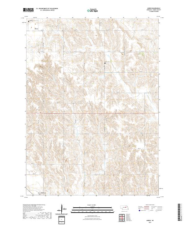
2021 Map of Akron
USGS Topo · Published 2021About this map
The unincorporated settlement of Akron and the village of Primrose anchor this 2021 study of Boone County, Nebraska. The landscape is defined by the agricultural grid of the Great Plains, where section lines are strictly maintained by roads such as 220th St and 160th Ave. Water courses like Plum Cr and Silver Valley Cr cut irregular patterns through the otherwise geometric township and range system, providing a natural contrast to the surveyed landscape. Genealogists and local historians can find specific burial sites at Akron Cem in the northwest and Dennison Cem further east along Dennison Rd. The map illustrates a rural economy reliant on a network of local connectors and gravel routes, including several stretches designated as Minimum Maintenance Rd, reflecting the sparse population and vast ranching and farming interests of central Nebraska in the early 21st century.
Find a feature on this map
30 named features on this map. Tap any name to fly to it.
Don’t see what you’re looking for? This feature index may not catch every label — zoom into the map to look around manually.
Map Details
Editions of this 2021 Akron Map
This is the sole edition of this map. No revisions or reprints were ever made.
Other maps of this area

1954 · Cedar Rapids
USGS Topo · 1:24,000

1954 · Spalding
USGS Topo · 1:24,000

1954 · Akron
USGS Topo · 1:24,000

1954 · Albion West
USGS Topo · 1:24,000

1954 · Cedar Rapids SE
USGS Topo · 1:24,000

1954 · Spalding SE
USGS Topo · 1:24,000

1955 · Broken Bow
USGS Topo · 1:250,000

1956 · Broken Bow
USGS Topo · 1:250,000

1960 · Spalding 2 SE
USGS Topo · 1:24,000

1963 · Petersburg
USGS Topo · 1:24,000