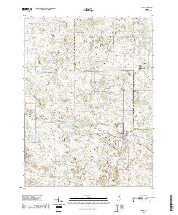
2022 Map of Akron
USGS Topo · Published 2022About this map
Akron serves as the primary hub of this north-central Indiana landscape, where the grid of Fulton County meets Kosciusko County. The area is defined by a dense network of drainage infrastructure, including the Chippewanuck Cr and numerous man-made channels like Graham Ditch and Rickle Ditch. These waterways manage a terrain dotted with glacial remnants such as Lake Sixteen, Town Lake, and Barr Lake. Local history is anchored by several long-standing community sites, most notably the Akron Independent Order of Odd Fellows Cem and the settlement at Athens. To the south, the Millark Millpond and Kelsey Lake suggest a history of water management and early milling. The map reveals a highly structured agricultural environment, with roads like E Division Rd and W State Rd 14 connecting scattered farmsteads and rural cemeteries like Hoovers Cem and Nichols Cem.
Find a feature on this map
60 named features on this map. Tap any name to fly to it.
Don’t see what you’re looking for? This feature index may not catch every label — zoom into the map to look around manually.
Map Details
Editions of this 2022 Akron Map
This is the sole edition of this map. No revisions or reprints were ever made.
Other maps of this area

1953 · Fort Wayne
USGS Topo · 1:250,000

1953 · Chicago
USGS Topo · 1:250,000

1953 · Danville
USGS Topo · 1:250,000

1953 · Muncie
USGS Topo · 1:250,000

1955 · Danville
USGS Topo · 1:250,000

1956 · Muncie
USGS Topo · 1:250,000

1956 · Danville
USGS Topo · 1:250,000

1956 · Fort Wayne
USGS Topo · 1:250,000

1957 · Chicago
USGS Topo · 1:250,000

1959 · Mentone
USGS Topo · 1:24,000