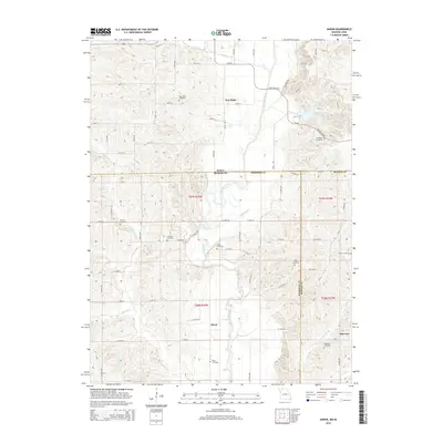
2015 Map of Akron
USGS Topo · Published 2015About this map
The Iowa-Missouri border cuts through this 2015 survey, revealing a landscape defined by the meandering Thompson River and a high density of small rural burial grounds. The settlement of Akron sits centrally within the quadrangle, south of the state line, while New Buda and Burrows anchor the northern and southeastern corners respectively. Genealogists will find a wealth of data points across the county lines of Harrison and Mercer in Missouri, including the New Buda Cemetery, Catholic Cemetery, and Fogleman Cemetery. Tributaries like Stone Quarry Creek and Jefferies Creek carve through the terrain, illustrating the drainage patterns that influenced the placement of early homesteads and these numerous family-named landmarks. The map also records the modern rural road network, with routes such as Dale Miller Road and CR-j66 connecting the dispersed farmsteads of the region.
Find a feature on this map
50 named features on this map. Tap any name to fly to it.
Don’t see what you’re looking for? This feature index may not catch every label — zoom into the map to look around manually.
Map Details
Editions of this 2015 Akron Map
This is the sole edition of this map. No revisions or reprints were ever made.
Other maps of this area

1945 · Lamoni
USGS Topo · 1:62,500

1946 · Princeton
USGS Topo · 1:62,500

1947 · Lamoni
USGS Topo · 1:62,500

1947 · Blythedale
USGS Topo · 1:62,500

1948 · Princeton
USGS Topo · 1:62,500

1954 · Centerville
USGS Topo · 1:250,000

1957 · Centerville
USGS Topo · 1:250,000

1958 · Centerville
USGS Topo · 1:250,000

1964 · Pleasanton
USGS Topo · 1:24,000

1964 · Leon
USGS Topo · 1:24,000