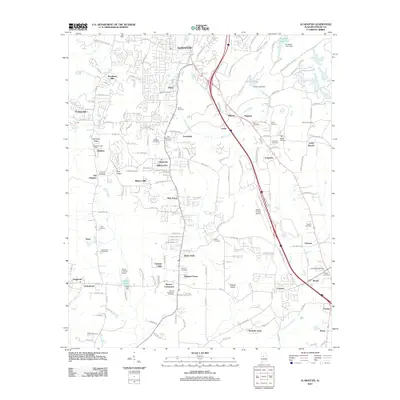
2011 Map of Alabaster
USGS Topo · Published 2011About this map
Alabaster and its surrounding Shelby County communities are shown here in the early 21st century, revealing a landscape of suburban expansion intertwined with long-standing rural settlements. The area around Siluria and Saginaw exhibits a dense network of residential streets like Kensington Ln and Fox Valley Farms Rd, while the southern reaches near Dogwood and Underwood maintain a more dispersed character. This period marks a high point in the region's aviation and logistics infrastructure, anchored by the Shelby County Airport and the Flying X Ranch Airport.
Find a feature on this map
144 named features on this map. Tap any name to fly to it.
Don’t see what you’re looking for? This feature index may not catch every label — zoom into the map to look around manually.
Map Details
Editions of this 2011 Alabaster Map
This is the sole edition of this map. No revisions or reprints were ever made.
Other maps of this area

1890 · Bessemer
USGS Topo · 1:125,000

1892 · Bessemer
USGS Topo · 1:125,000

1905 · Bessemer Iron District
USGS Topo · 1:62,500

1906 · Vandiver
USGS Topo · 1:62,500

1907 · Bessemer Special
USGS Topo · 1:62,500

1908 · Vandiver
USGS Topo · 1:62,500

1909 · Columbiana
USGS Topo · 1:62,500

1910 · Montevallo
USGS Topo · 1:62,500

1911 · Columbiana
USGS Topo · 1:62,500

1953 · Birmingham
USGS Topo · 1:250,000