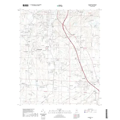
2020 Map of Alabaster
USGS Topo · Published 2020About this map
Alabaster and its surrounding communities are shown here at a moment of significant suburban expansion and infrastructure development in central Alabama. The map documents the geographical layout of established neighborhoods and newer developments across Opossum Valley and Cahaba Valley, featuring a high concentration of local history markers like Still Memorial Cem, Ozley Cem, and Nelson Cem. The landscape is defined by its natural water sources, including Griffin Spring and Blue Spring, which once supported the early settlements of Siluria and Saginaw. The presence of the Alabama National Cem in the southwest near Montevallo and the centrally located Shelby County Airport highlight the area's modern regional importance, while labels for Old Maylene and Stems provide clues for those tracing the evolution of Shelby County's residential and industrial corridors.
Find a feature on this map
231 named features on this map. Tap any name to fly to it.
Don’t see what you’re looking for? This feature index may not catch every label — zoom into the map to look around manually.
Map Details
Editions of this 2020 Alabaster Map
This is the sole edition of this map. No revisions or reprints were ever made.
Other maps of this area

1890 · Bessemer
USGS Topo · 1:125,000

1892 · Bessemer
USGS Topo · 1:125,000

1905 · Bessemer Iron District
USGS Topo · 1:62,500

1906 · Vandiver
USGS Topo · 1:62,500

1907 · Bessemer Special
USGS Topo · 1:62,500

1908 · Vandiver
USGS Topo · 1:62,500

1909 · Columbiana
USGS Topo · 1:62,500

1910 · Montevallo
USGS Topo · 1:62,500

1911 · Columbiana
USGS Topo · 1:62,500

1953 · Birmingham
USGS Topo · 1:250,000