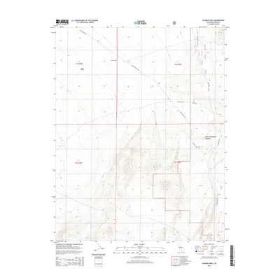
2015 Map of Alameda Well
USGS Topo · Published 2015About this map
Alameda Well sits within the high-desert landscape of Mono County, serving as a focal point for a network of remote roads and trails. The terrain transitions from the open floor of Mono Valley into the protected acreage of the Inyo National Forest. This 2015 survey reveals a land defined by its water-access history, where names like Deep Wells and Alameda Wells suggest the vital importance of groundwater in this arid region. The infrastructure is primarily composed of rugged access routes such as Dobie Meadow Rd, Deep Wells Cutoff, and the Huntoon Spur, illustrating how the landscape is navigated for forest management and local transit. The map provides a clear record of township and range boundaries including t3n r28e and t2n r29e, which are essential for property research and land-use studies in this part of California.
Find a feature on this map
14 named features on this map. Tap any name to fly to it.
Don’t see what you’re looking for? This feature index may not catch every label — zoom into the map to look around manually.
Map Details
Editions of this 2015 Alameda Well Map
This is the sole edition of this map. No revisions or reprints were ever made.
Other maps of this area

1909 · Hawthorne
USGS Topo · 1:250,000

1911 · Hawthorne
USGS Topo · 1:250,000

1914 · Mt. Morrison
USGS Topo · 1:125,000

1915 · Hawthorne
USGS Topo · 1:250,000

1947 · Mariposa
USGS Topo · 1:250,000

1948 · Walker Lake
USGS Topo · 1:250,000

1948 · Mariposa
USGS Topo · 1:250,000

1957 · Walker Lake
USGS Topo · 1:250,000

1957 · Mariposa
USGS Topo · 1:250,000

1958 · Trench Canyon
USGS Topo · 1:62,500