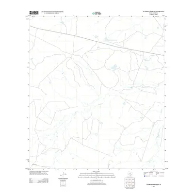
2013 Map of Alamito Creek NE
USGS Topo · Published 2013About this map
Becerra Cr and Salado Cr define the drainage patterns of this arid portion of Webb County, Texas. This 2013 survey illustrates a landscape primarily shaped by cattle ranching and water management, with several man-made impoundments scattered across the terrain. These include Nunley Lake, Nunley Lake Number 2, and Traylor Lake Number 2, which serve as vital watering points in this dry environment. The presence of Gallaghan Rd in the southwestern corner provides one of the few formal transportation links through the area, which is otherwise dominated by private ranch tracks and open pasture. The topographical detail reveals the subtle relief and drainage channels that sustain the local ecology in South Texas.
Find a feature on this map
6 named features on this map. Tap any name to fly to it.
Don’t see what you’re looking for? This feature index may not catch every label — zoom into the map to look around manually.
Map Details
Editions of this 2013 Alamito Creek NE Map
This is the sole edition of this map. No revisions or reprints were ever made.
Other maps of this area

1929 · Cotulla
USGS Topo · 1:125,000

1953 · Crystal City
USGS Topo · 1:250,000

1955 · Crystal City
USGS Topo · 1:250,000

1956 · Becerra
USGS Topo · 1:62,500

1956 · Piedra Creek
USGS Topo · 1:62,500

1956 · Las Mujeres
USGS Topo · 1:62,500

1956 · Laredo
USGS Topo · 1:250,000

1957 · Caiman Creek
USGS Topo · 1:62,500

1961 · Crystal City
USGS Topo · 1:250,000

1968 · Crystal City
USGS Topo · 1:250,000