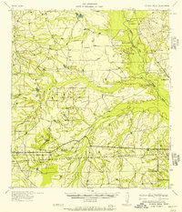
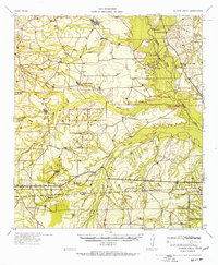
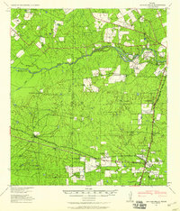
1957 Map of Caiman Creek
USGS Topo · Published 1957About this map
The Nueces River valley in the mid-1950s is a landscape defined by expansive ranching operations and seasonal hunting grounds across the La Salle and Webb County line. The terrain is deeply incised by a network of drainage systems, including Caiman Creek, Los Olmos Creek, and Tocolote Creek, which feed into the primary river corridor. This survey documents a transition from the historic past to mid-century rural life, marked by the presence of the Ft Ewell Monument near the riverbanks. Scattered homesteads and gathering points such as Hunter's Store and the Sheeran property serve as the social and economic anchors for this section of South Texas. The map identifies several significant livestock operations, including Jefferies Ranch, Burke Ranch, and the Willy Ranch, alongside numerous Hunting Lodges that indicate the land's dual use for agriculture and sport.
Find a feature on this map
21 named features on this map. Tap any name to fly to it.
Don’t see what you’re looking for? This feature index may not catch every label — zoom into the map to look around manually.
Map Details
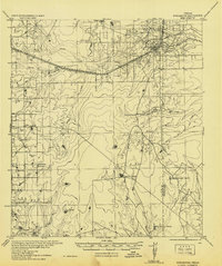
Editions of this 1957 Caiman Creek Map
2 editions found
Other maps of this area
1927 · Bart
USGS Topo · 1:62,500

1929 · Cotulla
USGS Topo · 1:125,000
1940 · Cotulla
USGS Topo · 1:62,500
1940 · Artesia Wells
USGS Topo · 1:62,500
1942 · Fowlerton
USGS Topo · 1:62,500

1953 · Crystal City
USGS Topo · 1:250,000

1955 · Crystal City
USGS Topo · 1:250,000

1956 · Becerra
USGS Topo · 1:62,500

1956 · Piedra Creek
USGS Topo · 1:62,500

1956 · Webb
USGS Topo · 1:62,500