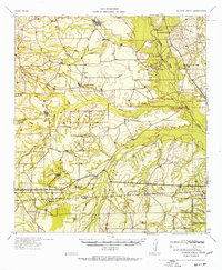
1957 Map of Caiman Creek
USGS Topo · Published 1957About this map
The Nueces River winds through this South Texas landscape, marking a terrain defined by cattle ranching and early frontier history. Near the river's edge, the Ft Ewell Monument stands as a reminder of the mid-19th century military post that once guarded the road from San Antonio to Laredo. The map reveals a sparsely settled region organized around established family operations such as Willy Ranch, Jefferies Ranch, and the Burke Ranch.
Find a feature on this map
21 named features on this map. Tap any name to fly to it.
Don’t see what you’re looking for? This feature index may not catch every label — zoom into the map to look around manually.
Map Details
Editions of this 1957 Caiman Creek Map
2 editions found

Other maps of this area

1927 · Bart
USGS Topo · 1:62,500

1929 · Cotulla
USGS Topo · 1:125,000

1940 · Cotulla
USGS Topo · 1:62,500

1940 · Artesia Wells
USGS Topo · 1:62,500

1942 · Fowlerton
USGS Topo · 1:62,500

1953 · Crystal City
USGS Topo · 1:250,000

1955 · Crystal City
USGS Topo · 1:250,000

1956 · Becerra
USGS Topo · 1:62,500

1956 · Piedra Creek
USGS Topo · 1:62,500

1956 · Webb
USGS Topo · 1:62,500