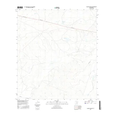
2016 Map of Alamito Creek NE
USGS Topo · Published 2016About this map
Nunley Lake and Traylor Lake Number 2 anchor the northern reaches of this brush country landscape in Webb County. The area is defined by a series of intermittent drainage systems, most notably Becerra Cr and Salado Cr, which carve subtle relief into the terrain. Ranching infrastructure dominates the human footprint here, with primary access provided by Ranch Rd 863 cutting east-to-west across the upper third of the quadrangle. Secondary routes like Becerra Rd and Gallaghan Rd trace the southern boundary, reflecting the vast, sparsely populated nature of South Texas ranchlands during the early 21st century. The map highlights the essential role of localized water catchments like Nunley Lake Number 2 in an otherwise arid environment.
Find a feature on this map
9 named features on this map. Tap any name to fly to it.
Don’t see what you’re looking for? This feature index may not catch every label — zoom into the map to look around manually.
Map Details
Editions of this 2016 Alamito Creek NE Map
This is the sole edition of this map. No revisions or reprints were ever made.
Other maps of this area

1929 · Cotulla
USGS Topo · 1:125,000

1953 · Crystal City
USGS Topo · 1:250,000

1955 · Crystal City
USGS Topo · 1:250,000

1956 · Becerra
USGS Topo · 1:62,500

1956 · Piedra Creek
USGS Topo · 1:62,500

1956 · Las Mujeres
USGS Topo · 1:62,500

1956 · Laredo
USGS Topo · 1:250,000

1957 · Caiman Creek
USGS Topo · 1:62,500

1961 · Crystal City
USGS Topo · 1:250,000

1968 · Crystal City
USGS Topo · 1:250,000