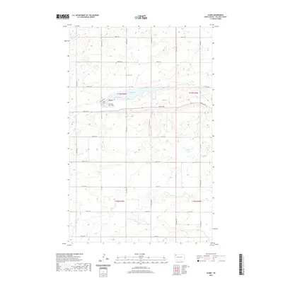
2020 Map of Alamo
USGS Topo · Published 2020About this map
Alamo serves as the central hub of this Williams County landscape, where the town's street grid meets the aviation strip at Overland-Lohse Field. The geography is defined by a series of low-lying water bodies and drainage systems, most notably Cottonwood Lake just east of the townsite and the winding course of the Little Muddy River in the southern sections. This survey provides a clear view of the section line road system that organizes the North Dakota prairie, including Railroad Ave and Co Hwy 11. For those researching local history or genealogy, the Alamo Cem is documented north of the settlement. The map illustrates a classic High Plains settlement pattern where small-town infrastructure is closely integrated with the surrounding agricultural sections, all tied together by a network of numbered township roads.
Find a feature on this map
26 named features on this map. Tap any name to fly to it.
Don’t see what you’re looking for? This feature index may not catch every label — zoom into the map to look around manually.
Map Details
Editions of this 2020 Alamo Map
This is the sole edition of this map. No revisions or reprints were ever made.
Other maps of this area

1911 · Ray
USGS Topo · 1:125,000

1948 · Smoky Butte
USGS Topo · 1:24,000

1948 · Alamo N.E.
USGS Topo · 1:24,000

1948 · Bright Water Lake
USGS Topo · 1:24,000

1953 · Williston
USGS Topo · 1:250,000

1957 · Williston
USGS Topo · 1:250,000

1974 · Twin Lakes
USGS Topo · 1:24,000

1977 · Appam
USGS Topo · 1:24,000

1977 · Alamo
USGS Topo · 1:24,000

1978 · Corinth
USGS Topo · 1:24,000