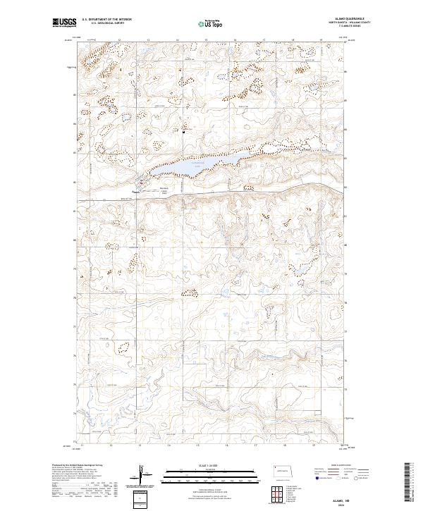
2024 Map of Alamo
USGS Topo · Published 2024About this map
Alamo serves as the central hub of this Williams County landscape, where the street grid of Railroad Ave and 1st Ave meets the prairie. The town's local history is anchored by the Alamo Cem to the north and the Overland- Lohse Field airstrip, reflecting the community’s reliance on both land and sky in this agricultural region. Just east of the settlement, Cottonwood Lake dominates the central terrain, while the southern reaches of the map are defined by the winding course of the Little Muddy River. A significant portion of the eastern landscape is dedicated to the Williams County Waterfowl Production Area, highlighting the importance of conservation and prairie wetlands. The map’s regular section lines and numeric road system, such as 80th St NW, underscore the organized surveying of the North Dakota plains.
Find a feature on this map
22 named features on this map. Tap any name to fly to it.
Don’t see what you’re looking for? This feature index may not catch every label — zoom into the map to look around manually.
Map Details
Editions of this 2024 Alamo Map
This is the sole edition of this map. No revisions or reprints were ever made.
Other maps of this area

1911 · Ray
USGS Topo · 1:125,000

1948 · Smoky Butte
USGS Topo · 1:24,000

1948 · Alamo N.E.
USGS Topo · 1:24,000

1948 · Bright Water Lake
USGS Topo · 1:24,000

1953 · Williston
USGS Topo · 1:250,000

1957 · Williston
USGS Topo · 1:250,000

1974 · Twin Lakes
USGS Topo · 1:24,000

1977 · Appam
USGS Topo · 1:24,000

1977 · Alamo
USGS Topo · 1:24,000

1978 · Corinth
USGS Topo · 1:24,000