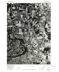
1976 Map of Albany
USGS Topo · Published 1980About this map
The Santiam River and Willamette River dominate this 1976 orthophotoquad, capturing the fertile valley landscape surrounding Albany and North Albany. The imagery reveals a complex agricultural patchwork defined by field boundaries and riparian corridors, showing the precise land use patterns of the mid-1970s. Further north, the settlement of Jefferson sits near the winding course of the Santiam, highlighting the historic reliance on these waterways for regional orientation and development. Unlike traditional line-drawn maps, this aerial perspective provides a literal view of the vegetation, road networks, and urban density as they existed during the Bicentennial year.
Find a feature on this map
5 named features on this map. Tap any name to fly to it.
Don’t see what you’re looking for? This feature index may not catch every label — zoom into the map to look around manually.
Map Details
Editions of this 1976 Albany Map
This is the sole edition of this map. No revisions or reprints were ever made.
Other maps of this area

1911 · Lebanon
USGS Topo · 1:31,680

1911 · Tangent
USGS Topo · 1:31,680

1912 · Jefferson
USGS Topo · 1:31,680

1913 · Oakville
USGS Topo · 1:31,680

1913 · Wells
USGS Topo · 1:31,680

1914 · Independence
USGS Topo · 1:31,680

1915 · Sidney
USGS Topo · 1:31,680

1916 · Albany
USGS Topo · 1:62,500

1917 · Salem
USGS Topo · 1:62,500

1921 · Lebanon
USGS Topo · 1:62,500