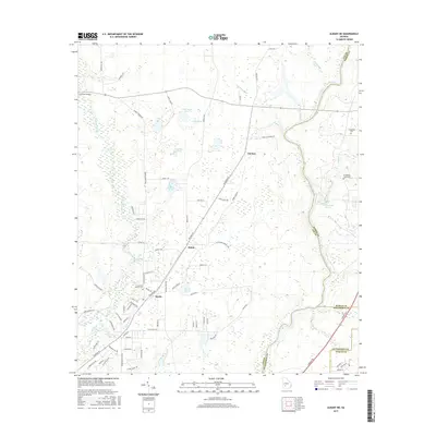
2017 Map of Albany NE
USGS Topo · Published 2017About this map
Beloit and the surrounding agricultural lands of Lee County are defined by the winding course of the Flint River and the tributary waters of Muckalee Creek. This 2017 survey details a landscape where water and heritage intersect, featuring numerous named ponds such as Duck Roost Pond, Cypress Pond, and White Pond. The area supports several small communities and historic gathering places, including Chehaw and Stocks. Genealogists will find significant value in the documentation of local burial grounds like Thundering Springs Cemetery and Old Mount Horeb Cemetery, which reflect long-standing family ties to the land. Notable hydrological landmarks like Thundering Spring and Grates Spring highlight the unique natural springs characteristic of this Georgia region, while the Forrester Bridge and a network of rural routes like Philema Road show the modern connectivity across this river-fed terrain.
Find a feature on this map
84 named features on this map. Tap any name to fly to it.
Don’t see what you’re looking for? This feature index may not catch every label — zoom into the map to look around manually.
Map Details
Editions of this 2017 Albany NE Map
This is the sole edition of this map. No revisions or reprints were ever made.
Other maps of this area

1953 · Dothan
USGS Topo · 1:250,000

1953 · Waycross
USGS Topo · 1:250,000

1954 · Dothan
USGS Topo · 1:250,000

1955 · Dothan
USGS Topo · 1:250,000

1956 · Albany East
USGS Topo · 1:24,000

1956 · Albany West
USGS Topo · 1:24,000

1956 · Sylvester
USGS Topo · 1:62,500

1956 · Albany
USGS Topo · 1:62,500

1956 · Leslie
USGS Topo · 1:62,500

1958 · Waycross
USGS Topo · 1:250,000