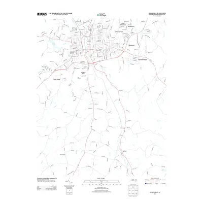
2013 Map of Albemarle
USGS Topo · Published 2013About this map
Windsor Hills and South Albemarle anchor the southern reaches of the city, where the suburban grid transitions into the creeks and ridges of rural Stanly County. This 2013 survey shows the organized growth of residential communities like Heathwood, Eastwood Park, and Anderson Heights clustered along the major transit corridors. Cultural landmarks such as the Stanly County Fairgrounds and the Badin Road Drive-In represent the local social fabric during this era of modernization.
Find a feature on this map
263 named features on this map. Tap any name to fly to it.
Don’t see what you’re looking for? This feature index may not catch every label — zoom into the map to look around manually.
Map Details
Editions of this 2013 Albemarle Map
This is the sole edition of this map. No revisions or reprints were ever made.
Other maps of this area

1953 · Charlotte
USGS Topo · 1:250,000

1954 · Charlotte
USGS Topo · 1:250,000

1956 · Mount Gilead West
USGS Topo · 1:24,000

1957 · Mount Pleasant
USGS Topo · 1:62,500

1957 · Albemarle
USGS Topo · 1:62,500

1960 · Charlotte
USGS Topo · 1:250,000

1962 · Charlotte
USGS Topo · 1:250,000
1971 · Oakboro
USGS Topo · 1:24,000
1971 · Aquadale
USGS Topo · 1:24,000
1977 · Albemarle SE
USGS Topo · 1:24,000