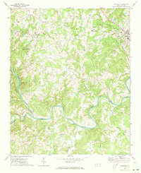
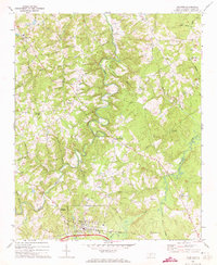
1971 Map of Aquadale
USGS Topo · Published 1973About this map
The Rocky River winds through the heart of this Piedmont landscape, defining the jagged border between Stanly and Anson Counties. This early 1970s survey captures the rural character of the region, where small agricultural hubs like Aquadale and Cottonville are connected by a network of creeks and branches. Transportation and industry are centered on the north and east, where the Norfolk Southern and Winston-Salem Southbound railroads intersect near Norwood. The presence of a Quarry and Claypits indicates the local extractive industry, while several country churches, such as Rehobeth Ch and Wightman Ch, serve as anchors for the surrounding community. Notable landmarks like Rocky River Springs and the nearby Campground suggest a history of seasonal gatherings or local recreation along the tributary waters of Haw Branch and Alligator Branch.
Find a feature on this map
46 named features on this map. Tap any name to fly to it.
Don’t see what you’re looking for? This feature index may not catch every label — zoom into the map to look around manually.
Map Details
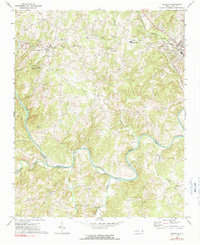
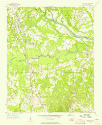
Editions of this 1971 Aquadale Map
2 editions found
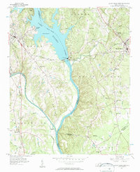
Other maps of this area

1953 · Charlotte
USGS Topo · 1:250,000

1954 · Charlotte
USGS Topo · 1:250,000
1956 · Ansonville
USGS Topo · 1:24,000
1956 · Mount Gilead West
USGS Topo · 1:24,000

1957 · Mount Pleasant
USGS Topo · 1:62,500

1957 · Albemarle
USGS Topo · 1:62,500

1960 · Charlotte
USGS Topo · 1:250,000

1962 · Charlotte
USGS Topo · 1:250,000
1970 · Polkton
USGS Topo · 1:24,000
1970 · Olive Branch
USGS Topo · 1:24,000