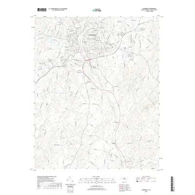
2019 Map of Albemarle
USGS Topo · Published 2019About this map
Albemarle serves as the primary urban center for this portion of Stanly County, positioned amidst a complex network of streams and rural bypasses. The residential and commercial grid of the town is bordered by significant commemorative sites, including Fairview Cem, Fairview Memorial Park Cem, and Stanly Gardens Cem, which provide a detailed record of the area's local genealogy. To the south, the settlement of Porter marks a transition into a more rural landscape defined by family-named routes like Mauldin Rd and Huneycutt Mill Rd.
Find a feature on this map
195 named features on this map. Tap any name to fly to it.
Don’t see what you’re looking for? This feature index may not catch every label — zoom into the map to look around manually.
Map Details
Editions of this 2019 Albemarle Map
This is the sole edition of this map. No revisions or reprints were ever made.
Other maps of this area

1953 · Charlotte
USGS Topo · 1:250,000

1954 · Charlotte
USGS Topo · 1:250,000

1956 · Mount Gilead West
USGS Topo · 1:24,000

1957 · Mount Pleasant
USGS Topo · 1:62,500

1957 · Albemarle
USGS Topo · 1:62,500

1960 · Charlotte
USGS Topo · 1:250,000

1962 · Charlotte
USGS Topo · 1:250,000
1971 · Oakboro
USGS Topo · 1:24,000
1971 · Aquadale
USGS Topo · 1:24,000
1977 · Albemarle SE
USGS Topo · 1:24,000