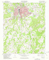
1981 Map of Albemarle
USGS Topo · Published 1982About this map
The city of Albemarle dominates the northern half of this 1981 survey, showing a well-established textile and industrial center at a moment of transition. The municipal core is dense with civic infrastructure, including the County Hospital, City Hall, and the Library, while the outlying areas are shaped by the convergence of the Winston-Salem Southbound and Norfolk Southern railroads. To the south, the landscape shifts into a rural patchwork of small-scale agriculture and timber, dotted with family-named landmarks and country churches like Union Grove Ch and Silver Spring Ch.
Find a feature on this map
48 named features on this map. Tap any name to fly to it.
Don’t see what you’re looking for? This feature index may not catch every label — zoom into the map to look around manually.
Map Details
Editions of this 1981 Albemarle Map
This is the sole edition of this map. No revisions or reprints were ever made.
Other maps of this area

1953 · Charlotte
USGS Topo · 1:250,000

1954 · Charlotte
USGS Topo · 1:250,000

1956 · Mount Gilead West
USGS Topo · 1:24,000

1957 · Mount Pleasant
USGS Topo · 1:62,500

1957 · Albemarle
USGS Topo · 1:62,500

1960 · Charlotte
USGS Topo · 1:250,000

1962 · Charlotte
USGS Topo · 1:250,000
1971 · Oakboro
USGS Topo · 1:24,000
1971 · Aquadale
USGS Topo · 1:24,000
1977 · Albemarle SE
USGS Topo · 1:24,000
Featured Places
- Albemarle, NC
- Eastwood Park, Albemarle
- Cedar Village, NC
- Anderson Heights, Albemarle
- Heathwood, Albemarle