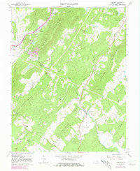
1967 Map of Alberene
USGS Topo · Published 1981About this map
Alberene and the surrounding soapstone quarrying district are central to this 1967 survey of Albemarle County, which captures the area before modern development altered its rural character. The landscape is defined by the ridge systems of Dudley Mountain and Carters Mountain, with numerous small communities and crossroads such as Red Hill and Powell Corner established along the valley floors. The economy of the era is visible in the network of quarries and the Southern Railroad Grade that historically served the local industry.
Find a feature on this map
47 named features on this map. Tap any name to fly to it.
Don’t see what you’re looking for? This feature index may not catch every label — zoom into the map to look around manually.
Map Details
Editions of this 1967 Alberene Map
2 editions found
Other maps of this area

1891 · Palmyra
USGS Topo · 1:125,000

1892 · Buckingham
USGS Topo · 1:125,000

1892 · Gordonsville
USGS Topo · 1:125,000

1892 · Harrisonburg
USGS Topo · 1:125,000

1895 · Palmyra
USGS Topo · 1:125,000

1897 · Palmyra
USGS Topo · 1:125,000

1929 · Covesville
USGS Topo · 1:62,500

1931 · University
USGS Topo · 1:62,500

1935 · Charlottesville
USGS Topo · 1:62,500

1935 · Charlottesville And Vicinity
USGS Topo · 1:31,680