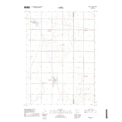
2018 Map of Albert City
USGS Topo · Published 2018About this map
Albert City and Marathon anchor this 2018 survey of the northwest Iowa plains, where the grid of rural roads and section lines defines the agricultural landscape of Buena Vista and Pocahontas counties. The terrain is notably marked by numerous cemeteries and resting places, providing essential records for genealogists including Poland Cem, Swan Lake Cem, Smith Cem, Fairfield Cem, and Marshall Cem. Of particular historical interest is the Garton Graveyard, which sits alone amidst the fields of T93N R35W. The area's drainage and water management are visible through features like the Little Cedar Cr and the engineered Lateral Number 2, reflecting the modification of the prairie for intensive farming. The map traces the residential streets of Albert City from Main St to Flower St, alongside the northern settlement of Marathon with its orientation around W Attica St.
Find a feature on this map
46 named features on this map. Tap any name to fly to it.
Don’t see what you’re looking for? This feature index may not catch every label — zoom into the map to look around manually.
Map Details
Editions of this 2018 Albert City Map
This is the sole edition of this map. No revisions or reprints were ever made.
Other maps of this area

1954 · Fort Dodge
USGS Topo · 1:250,000

1957 · Fort Dodge
USGS Topo · 1:250,000

1958 · Fort Dodge
USGS Topo · 1:250,000

1971 · Sioux Rapids SE
USGS Topo · 1:24,000

1971 · Albert City
USGS Topo · 1:24,000

1971 · Rush Lake East
USGS Topo · 1:24,000

1971 · Rush Lake West
USGS Topo · 1:24,000

1971 · Laurens
USGS Topo · 1:24,000

1971 · Webb
USGS Topo · 1:24,000

1979 · Varina
USGS Topo · 1:24,000