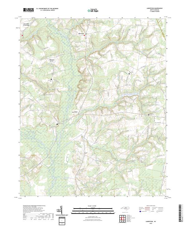
2022 Map of Albertson
USGS Topo · Published 2022About this map
Albertson and Kornegay anchor this rural pocket of Duplin and Lenoir counties, where the Northeast Cape Fear River snakes through a landscape defined by expansive wetlands. The drainage of Goshen Swamp and its numerous tributaries, including Burn Coat Cr and Panther Cr, shapes the local settlement patterns. Small communities like Herrings Crossroads and Pleasant Grove are connected by a network of family-named roads, reflecting a deeply rooted local history. Genealogists will find significant detail in the mapping of several rural burial grounds, including Will Taylor Cem, Westbrook Cem, and the Oak Ridge Memorial Cem. The prominence of water features like Maxwell Millpond and Turner Pond points to a landscape historically dependent on local water resources and hydraulic engineering in the Eastern North Carolina coastal plain.
Find a feature on this map
84 named features on this map. Tap any name to fly to it.
Don’t see what you’re looking for? This feature index may not catch every label — zoom into the map to look around manually.
Map Details
Editions of this 2022 Albertson Map
This is the sole edition of this map. No revisions or reprints were ever made.
Other maps of this area

1943 · Kenansville
USGS Topo · 1:62,500

1948 · Kenansville
USGS Topo · 1:62,500

1948 · Richlands
USGS Topo · 1:62,500

1953 · Rocky Mount
USGS Topo · 1:250,000

1953 · Beaufort
USGS Topo · 1:250,000

1954 · Rocky Mount
USGS Topo · 1:250,000

1954 · Beaufort
USGS Topo · 1:250,000

1957 · Seven Springs
USGS Topo · 1:62,500

1958 · Deep Run
USGS Topo · 1:62,500

1965 · Richlands
USGS Topo · 1:62,500