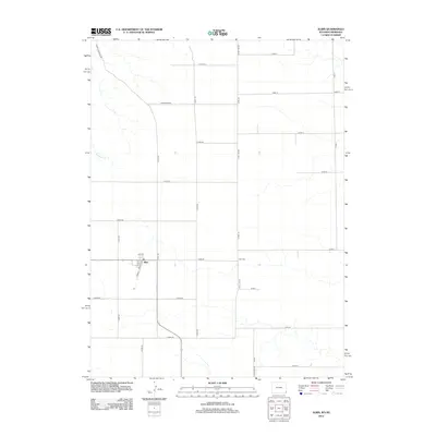
2012 Map of Albin
USGS Topo · Published 2012About this map
Albin serves as the central hub of this agricultural landscape in the far eastern reaches of Laramie County, appearing here in the early 21st century. The town's grid is clearly defined by 1st Ave, Elm St, and Wolcott St, while the surrounding section lines form a rigid network of county roads. One of the most significant landmarks for local researchers is the Albin Cem, located east of the main settlement. The terrain is characterized by the subtle drainage of Bushnell Cr, which cuts across the northwest. This survey also documents the geopolitical boundary of the Wyoming-Nebraska border, represented by State Line Rd. Named routes like Holgerson Rd and the Albin-La Grange Rd suggest the importance of regional connectivity for the surrounding farmsteads and ranches.
Find a feature on this map
30 named features on this map. Tap any name to fly to it.
Don’t see what you’re looking for? This feature index may not catch every label — zoom into the map to look around manually.
Map Details
Editions of this 2012 Albin Map
This is the sole edition of this map. No revisions or reprints were ever made.
Other maps of this area

1898 · Scotts Bluff
USGS Topo · 1:125,000

1899 · Goshen Hole
USGS Topo · 1:125,000

1954 · Scottsbluff
USGS Topo · 1:250,000

1954 · Cheyenne
USGS Topo · 1:250,000

1958 · Cheyenne
USGS Topo · 1:250,000

1958 · Scottsbluff
USGS Topo · 1:250,000

1960 · Tremain
USGS Topo · 1:24,000

1960 · Petsch Reservoir
USGS Topo · 1:24,000

1963 · Lindbergh
USGS Topo · 1:24,000

1963 · Gurney Peak
USGS Topo · 1:24,000