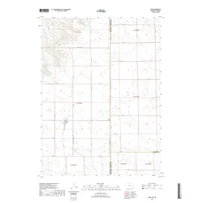
2018 Map of Albin
USGS Topo · Published 2018About this map
Albin serves as the focal point of this high-plains landscape, situated just west of the tripartite border where Wyoming, Nebraska, and two counties intersect. The town's grid is clearly defined by Albin St and Wolcott St, while the surrounding sections are carved into a strict rectilinear pattern of county roads. One of the few breaks in this geometric layout is the wandering path of Bushnell Cr in the northwest, which provides a natural contrast to the surveyed township lines like t17n r60w.
Find a feature on this map
36 named features on this map. Tap any name to fly to it.
Don’t see what you’re looking for? This feature index may not catch every label — zoom into the map to look around manually.
Map Details
Editions of this 2018 Albin Map
This is the sole edition of this map. No revisions or reprints were ever made.
Other maps of this area

1898 · Scotts Bluff
USGS Topo · 1:125,000

1899 · Goshen Hole
USGS Topo · 1:125,000

1954 · Scottsbluff
USGS Topo · 1:250,000

1954 · Cheyenne
USGS Topo · 1:250,000

1958 · Cheyenne
USGS Topo · 1:250,000

1958 · Scottsbluff
USGS Topo · 1:250,000

1960 · Tremain
USGS Topo · 1:24,000

1960 · Petsch Reservoir
USGS Topo · 1:24,000

1963 · Lindbergh
USGS Topo · 1:24,000

1963 · Gurney Peak
USGS Topo · 1:24,000